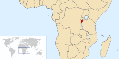
La Republic of Burundi is a small country located in East africa that has no outlet to the sea. Borders with Rwanda, Tanzania and the Democratic Republic of the Congo. In its western border it comes to limit with Lake Tanganyika. Before it was called Urundi-Ubrundi-Bruwanda. The current name comes from the language Bantu Kirundi.

Between 1993 and 1999, the ethnic violence that took place in Rwanda between Hutus and Tutsis produced thousands of refugees in the surrounding countries, as Burundi, which tried to secure its borders by intervening in the conflict in the Democratic Republic of Congo.

Burundi it is generally a mountainous country, especially in the west, where there are also plains near the border with Tanzania. Its heights range from 770 meters on the banks of the lake tanganyika up to 2670 meters in the Mount Heha.

It has an equatorial climate, which varies with altitude and the average temperatures that change every year. There are wet seasons from February to May and from September to November and dry seasons from December to January.
This article has been shared 20 times. We have spent many hours collecting this information. If you liked it, share it, please: